Trail Closure Forecast
PROTrail Info
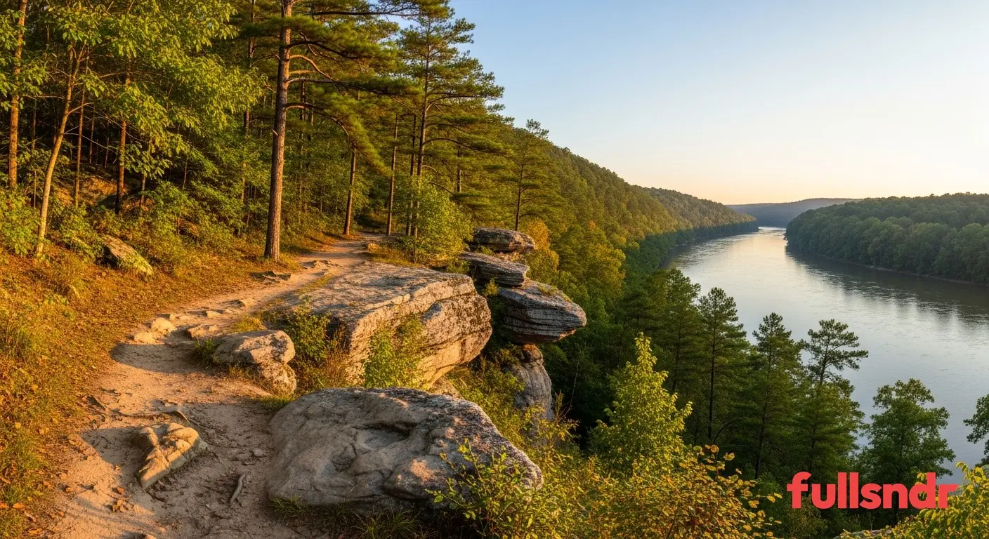
Sprewell Bluff State Park near Thomaston, Georgia offers hiking trails along the Flint River with scenic bluffs and rocky outcrops. A quiet outdoor destination in the Georgia Piedmont.
Sprewell Bluff State Park Trail Status
Trail status monitoring for Sprewell Bluff State Park is coming soon. Riders in Thomaston, Georgia and across the region have been signing up for updates, and fullsndr is working to bring real-time trail conditions here. Sign up below to be the first notified when monitoring goes live.
About Sprewell Bluff State Park
Sprewell Bluff State Park near Thomaston, Georgia offers hiking trails along the Flint River with scenic bluffs and rocky outcrops. A quiet outdoor destination in the Georgia Piedmont.
Trail Details
With 5 miles of trail, Sprewell Bluff State Park offers a compact, tightly curated system that rewards repeat visits. The trail supports hiking. Terrain is accessible for riders and hikers of all experience levels, with smooth surfaces and gentle grades that make it welcoming for families and newcomers.
Location and Getting There
Sprewell Bluff State Park is located in Thomaston, Georgia, in Upson County. The Southeast Georgia and West Georgia region is home to some of the best trail systems in the state, with red clay singletrack, pine and hardwood forests, and a riding season that stretches nearly year-round thanks to the mild climate.
Weather and Trail Conditions
Trail conditions at Sprewell Bluff State Park are heavily influenced by weather in the Georgia Piedmont. Spring brings the highest rainfall and most closures. Summer afternoon thunderstorms can dump heavy rain quickly, but trails often drain within hours on well-built systems. Fall is peak riding season in the Southeast with dry, cool conditions from September through November. Winter is generally rideable but freeze-thaw cycles and occasional ice events can close trails temporarily.
Soil saturation is the biggest factor in trail closures across Georgia. After heavy rain, clay-heavy surfaces can take 24 to 48 hours to dry depending on temperature, humidity, and sun exposure. Riding on saturated trails causes ruts and erosion that costs thousands of dollars to repair. fullsndr tracks precipitation, soil moisture, and historical closure patterns to help you plan rides when conditions are actually good.
Why Trail Status Matters
Showing up to a closed trail is not just disappointing. Riding on wet or closed trails damages professionally built trail surfaces, creates ruts that channel water and accelerate erosion, and can cost trail organizations tens of thousands of dollars in repairs. Trail closures exist to protect the investment that volunteers, land managers, and conservation groups have made in building and maintaining these systems.
fullsndr exists to solve this problem. Free trail status notifications keep you informed so you can plan rides when conditions are actually right. You avoid wasted trips, and trail builders avoid the damage that comes from uninformed riding. Everyone wins.
Trail Management
Georgia State Parks is responsible for maintaining and managing Sprewell Bluff State Park. Trail organizations like this put in countless volunteer hours building, maintaining, and repairing trail surfaces. Supporting them through donations, volunteer days, and responsible riding practices is the best way to keep these trails open for the long term.
Get Notified When Monitoring Starts
fullsndr is expanding trail monitoring across Georgia. Sign up below to be notified the moment we begin tracking conditions at Sprewell Bluff State Park. You will also receive updates on any trail systems in the area that are already active.
Get Sprewell Bluff State Park Trail Alerts
Get notified instantly when trails open or close. Free forever.